
We provide outstanding
natural resources survey
Freshwater ecological surveys &
water pollution assessments
Client-focused
e prioritize the needs and goals of our clients. We work closely with each client to understand their specific needs and develop customized solutions that meet their unique requirements. We are committed to delivering high-quality services and exceeding our clients' expectations
Comprehensive services
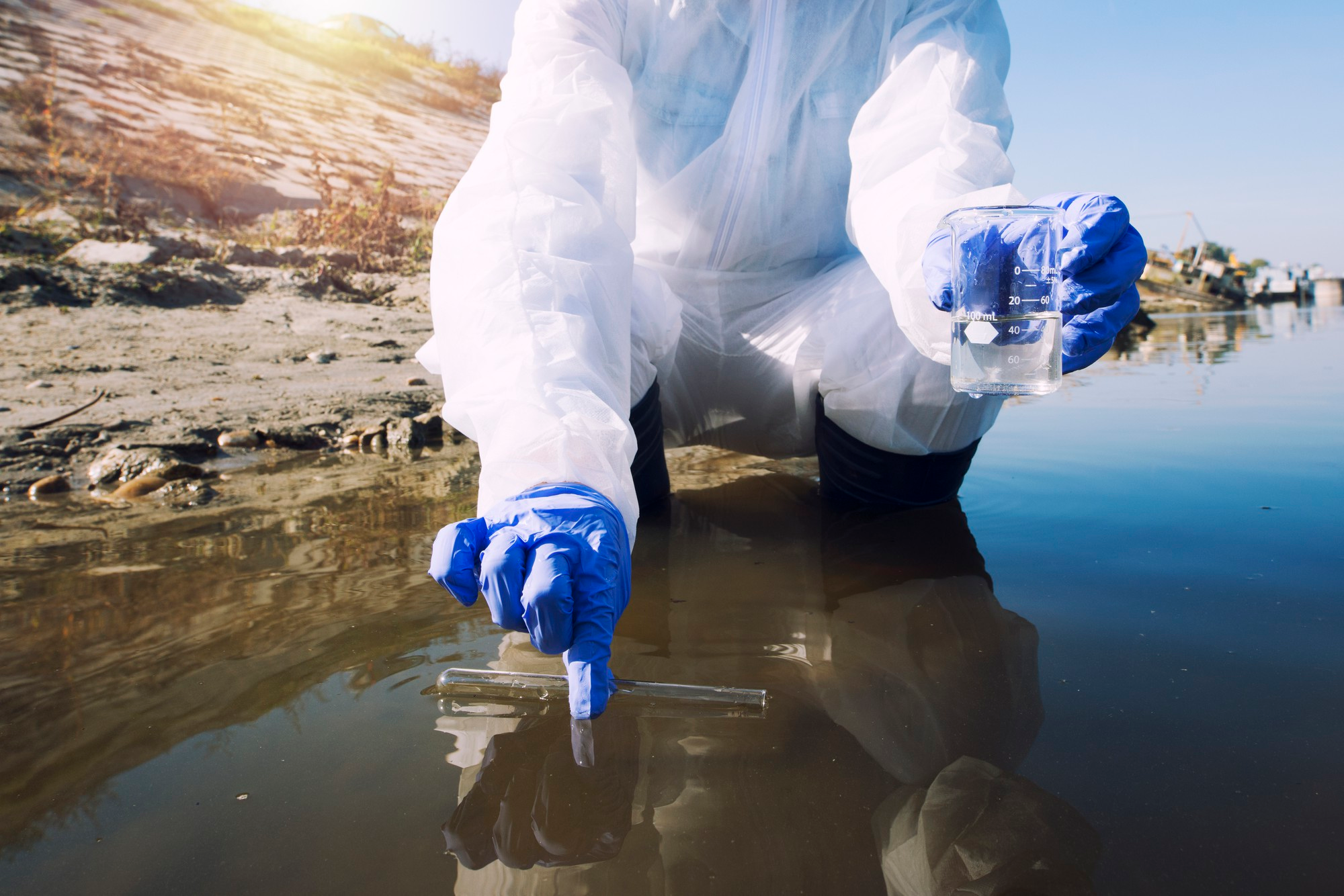
We offer a wide range of services related to freshwater ecological and natural resources surveys, including fish surveys, water quality assessments, aquatic vegetation surveys, and much more. We provide comprehensive, all-in-one services to help our clients get the information they need to make informed decisions about freshwater ecosystems
Innovative Technologies
we utilize the latest technology and cutting-edge techniques to conduct our surveys and research. From advanced sonar and GPS equipment to drone mapping and remote sensing technology, we have the tools needed to provide detailed and accurate information about freshwater ecosystems
ABOUT US
Quality is Pride of Workmanship
KORADIS LTD provides technical assistance and advisory services in the fields of Mapping science(web mapping, planimetric surveys,Geodetic surveys), spatial database design and implementation, Remote sensing application projects like; (Landuse mapping, Stereo mapping with areal photos), hydro-geological surveys, thematic baseline surveys, modelling( Water domain modelling) and also we offer thematic training in GIS , spatial databases, Remote sensing and water resources modelling. The consultants are registered and licensed by the relevant regulatory and professional bodies like the Institute of Surveyors of Kenya (ISK) National Environmental Management Authority (NEMA), Engineers Registration Board and Physical Planners Registration Board (PPRB). At Koradis we are committed to provide high quality services that are affordable and sustainable.
Unlocking the secrets of freshwater ecosystems through rigorous research.
Our Ojectives
The Best Service For You
Environmental resources management
Assist in the establishment of information databases for natural resources & environmental management.
Capacity Building
Build capacity to various clients in the use of geo-information technologies, surveying navigation and environmental management.
Consultancy and Advisory Services
Provide advisory services in the application of geo-information technologies in project implementation.
Experts Training
Work closely with training institutions in the development of Remote Sensing and GIS and training of experts in these fields.
Policies Development
Develop Environmental Information Systems addressing global or regional environmental concerns such as desertification, floods etc;
Environment data analysis
Customize existing methodologies to suit the specific needs of member in environmental data manipulation and analysis.
Have Any Question For Project Plan In Your Mind?
GET IN TOUCH ACHIVEMENTS
Championing sustainability and biodiversity in freshwater environments,
we work closely with local communities to build partnerships and collaborations that help safeguard freshwater resources. We also provide education and awareness programs to help raise awareness about the importance of freshwater ecosystems and how we can all do our part to protect them
25+
Complete Projects
16+
Active On Clients
11
Experience Team
2
Winning Awards
